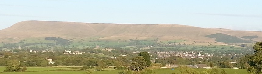
The Tour of Pendle Fell Race.
This is a description of the course of the “Tour of Pendle Fell Race”, locally referred to as “The Tour”. It should be read with the maps and sketches of the course, which can be found on the Tour website. www.tourofpendle.co.uk
Ordnance Survey map 103, Blackburn & Burnley (Clitheroe & Skipton).
The route shown on these sketches is generally that preferred by runners of previous Tour races. No part of the course is flagged but flags may be used in small local areas to protect the environment. Please follow the flags. A fully waterproof map showing the course is available from Pete Bland Sports of Kendal.
Registration: GR 823 403. Barley Village Hall.
Start: GR 822 402. Just before the Old Water Works which is now private dwellings. Please respect their privacy.
C.P.1: GR 794 419. Steel gate in wall, Pendle Hill.
The race starts in the lane just before the Old Water Works in Barley, which is 100m’s past Race Registration Barley Village Hall. Follow this lane passing Lower Ogden Res on your left and rise into the trees. On exit from the trees fork right onto the concrete track, climb and pass through the gate in front of you, turn right and climb, keeping the wall on your right, to another gate. Pass through the gate, cross the track, pass through the next gate. All these gates will be open & marshalled on race day. Continue climbing to the Big End and the trig point. Pass the trig point and proceed to the stile/gate 100m’s in front of you. Go through the gate and take the path to the left at approximately 45deg to the gate. Follow that path to steel gate in the wall which is now CP1. This gate will be open & marshalled on race day.
C.P.2: GR 773 384. Above the quarry at Nick o’ Pendle.
Follow the path in front of you, pass the shelter and the Scout Memorial Cairn and continue on the stoney path created by the peat hag restoration project. After this path runs out you take a trod to your left and head for the Nick o’ Pendle and CP2. The trod is not heavily defined and leads you across wet bogey ground, you cross a wall onto more bogey ground but eventually pick up a path, which leads to the main path from the Trig Point to The Nick o’ Pendle. Run on the left hand side of the path and as you approach Apronful Hill you will see the path fork, take the right hand path and pass Apronful on your right. Follow the path along the ridge to CP2.
If you are in difficulties at this point and want to drop out speak to the marshal who may be able to give you a lift back to Barley.
C.P.3: GR 786 385. Gate at reservoir inlet stream.
Turn south east from CP 2 and head for Churn Clough Res which can be seen on a clear day as you leave CP 2. Follow the path and pick up the track just below you on the right, follow the track, pass through the gate and move forward to crest the height in front of you with the wall on your left and the Res in front. Cross the stile in the wall, descend to the gate, pass through and join the track around the Res. Follow the track, cross the bridge over the Res inlet stream: this is CP3. Turn immediate left and climb the stone stile.
C.P.4: GR 801 397. Gate in fence in Ogden Clough, as stream “crosses” fell wall.
From CP 3 follow the stream, then the fence and climb to the wall, passing the large holly bush. Cross the wall, turn right and climb. When you come to a wall in front of you turn right, cross the wall and turn left and with the wall now on your left, crest the climb and cross the wall at the stile. Turn right and follow the wall for approx. 15m and as the wall turns to the right you turn to the left and follow that path crossing the eastern side of Spence Moor and descend into Ogden Clough, crossing the brook to CP 4 at the gate. This descent is locally known as Geronimo.
A cut-off time will be rigidly enforced at this CP. If you do not make this cut-off time you will be directed back to the finish. The “cut-off” time is 12:30pm.
The route back is as follows; pass through the gate in the wall, (Bill’s Gate) approximately 10m’s to your right and follow the path which leads to the lane you followed from the start. You must report to registration, ensure your retirement is recorded by a race official.
C.P.5: GR 772 394. Wall corner.
Pass through the gate at CP4 and follow the path upstream, cross Ogden Brook and climb, when you reach the path at the remains of a stone cairn, turn left and follow it to Apronful Hill approaching the hill on its right hand side. From Apronful descend to CP 5 following the trod to a point just above the wall corner.
C.P.6: GR 783 405. Grassy Knoll in front of Geoff’s Tarn. Pendle Moor.
Leaving CP 5 follow the trod, cross Howcroft Brook in Ashendean Clough and climb Mearley Moor to the wall corner and cairn, with the wall and cairn on your left, follow it forward to the wall tee on your left, pass through the gap in the wall and turn right. With the wall on your right follow the path to a small grassy knoll with a tarn behind it, this is CP 6. Access to any of the area on your left is out of bounds due to erosion and the creation of a heavily marked, sloppy path, please STAY OFF. The cairn which is CP 8 can be seen from here on a clear day. You still have to visit CP 7.
C.P.7: GR 783 413. Mearley Brook “crossing” of fell wall.
Follow the trod, pass through the gap in the wall and continue, descend to the wall, turn right, follow the wall and cross the brook at the point where Mearley Brook passes under the fell wall/fence, to CP7. Do not descend into the brook too early, go to the wall, the banking there is very loose. The last 3 or 4m of this descent into the brook are particularly steep.
C.P.8: GR 789 414. Alistair’s / Scout memorial cairn.
Follow the trod and climb to the cairn which is CP 8. This climb is referred to locally as the Big Dipper. Turn left.
C.P.9: GR 807 424. Grassy knoll above wall tee.
Turn left at CP8 and follow the trod to the wall, passing the circular shelter just before the gate. Go through the gate, which is also CP1, and follow the trod forward (do not fork right). After 100m’s or so take the path to the left and descend to a lower path which will take you to CP9. The CP is on a grassy mound above the fell wall, near the wall tee on the eastern end of Downham Moor.
Alternatively you could continue past the above mentioned path and after crossing two grassed over tracks descend to CP9 This track is usually dry and firm and the descent is steeper which I prefer.
C.P.10:GR 804 418. Shelter at the wall above CP9.
Turn at CP9 and climb back up to the gate in the wall (GR 804 418), go through the gate and CP10 is on the right.
C.P.11:GR 801 397. Gate (Bill’s Gate) in wall as stream “crosses” fell wall.
Follow the trod to the trig point. The main path from the trig point does not lead to CP11. As the fell flattens out there is a narrow trod off to the right that descends into Ogden Clough and CP11. This is open moor and if under cloud the area is featureless, at this stage in the race do not take a risk on missing CP11; take a bearing from the trig point. I estimate 200deg but check it.
On a clear day, when Spence Moor is visible at the other side of Ogden Clough, the first wall on your left on that moor, drops down to C.P. 11 in Ogden Clough and can be seen and used as a visible bearing, run at it, on your way you will eventually end up on the trod. The wall is by far the better bearing. If you wander to the left and come to a wall turn right and follow it, this wall also drops down to CP11.
There is approx 10m between CP11 and CP4; they are close together. Pass through the gate at the check point and and follow the path, passing Upper Ogden Res on your right. Descend to the lane and follow it to the finish outside the Village Hall 823 403.
I have written this description in the hope it is clear to follow and will aid you to successfully complete the course. If there is anything that is not correct or misleading, please let me know and I will amend it.
Kieran F. Carr, 18October 2022.